By the end of this article, you'll know what a ghost forest is, how to recognize why one forms, and what North Carolina's coast is telling us about how landscapes fail. The short version: a new study, reported by Phys, found that coastal forests in North Carolina have declined by 21% since 1985, and the pace of loss picked up sharply after 2010.
The research focused on the Albemarle-Pamlico Peninsula, using satellite imagery and AI to track forest change across decades. The study also suggests the loss may still be speeding up, per the report.
What a ghost forest actually is
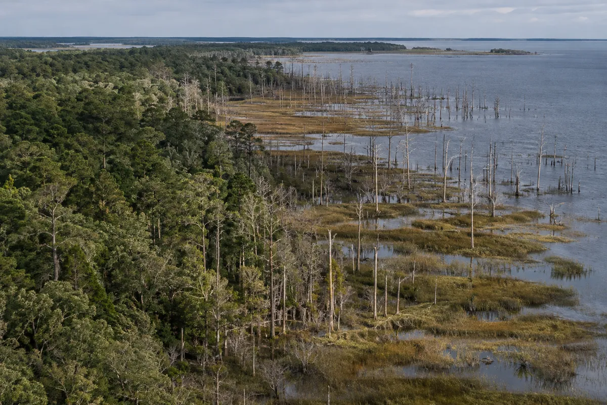
A ghost forest is a stand of dead or dying trees, often still standing, left behind when conditions change faster than the trees can handle. On the North Carolina coast, the culprits named in the study coverage are rising sea levels and saltwater intrusion. Salt moves into soil and groundwater that trees evolved to grow in as fresh or only slightly salty. The trees weaken, die, and leave pale, bare trunks.
The key point is that this isn't a clear-cut or a fire. The forest doesn't vanish overnight. It dies in place, which can make the damage easy to miss from the ground until large areas have already turned.
The numbers that matter
According to the Phys report on the study:
- Coastal forests in North Carolina have declined by 21% since 1985.
- Loss began accelerating after 2010.
- It may still be speeding up.
That pattern is the real story. A steady decline is worrying but manageable to plan around. An accelerating one means each year's loss is bigger than the last, and past trends understate what's coming.
Why the acceleration is the warning sign
The study points to a combination of long-term change and short-term shocks. Sea level rise is slow and constant. Extreme weather, such as drought and hurricanes, hits in bursts. Together, they can push a landscape past a point where it recovers.
Here's one way to picture it (this is our analogy, not the researchers'): a tree stressed by slowly increasing salt is like a person carrying a heavier and heavier backpack. A single storm or dry spell doesn't have to be extraordinary to be the thing that finally knocks it over.
That's why the timing after 2010 is worth attention. When slow pressure and sudden shocks overlap, losses can jump rather than creep.
Protected land isn't a shield
The coverage describes this as a case where even protected areas can see forests fail. That matters because many people assume that setting land aside keeps it intact. Protection can stop logging and development. It can't hold back the ocean or stop saltwater from moving into the soil.
If you care about conservation, this shifts the question from "is the land protected?" to "can the ecosystem still function as conditions change?" Those are different questions, and the second is much harder.
How AI and satellites made this visible
Spotting forest loss across a whole peninsula over four decades isn't something you can do on foot. The researchers used satellite imagery combined with AI to track change at scale. That approach lets scientists compare the same places year after year and see not just that forests are shrinking, but when the rate of shrinking changed.
That last part is what makes the 2010 turning point detectable. Without a long, consistent record, a bend in the curve like that is easy to miss.
What you can do with this information
You don't need to live in North Carolina for this to be useful. A few practical steps:
- Look for the signs locally. If you live near a coast or tidal river, watch for stands of dead trees standing in areas that used to be healthy forest. Standing dead trees near salty or brackish water can be an early signal.
- Check public satellite tools. Free map services show historical imagery in many places, so you can compare your own area across years.
- Support monitoring, not just protection. Long-term data is what revealed this acceleration. Funding for research and monitoring helps communities spot trouble earlier.
- Ask local officials about coastal planning. If forests are failing, that affects land use decisions, and it's worth asking whether plans account for it.
The takeaway
North Carolina's coastal forests have lost 21% since 1985, and the losses picked up after 2010. If you live near a coast, take ten minutes this week to compare satellite images of your area from different years. What looks stable from the ground may be changing faster than you think.